
Start with the depot
Weiser's railroad story is visible in the town plan before a visitor enters any building. The Oregon Short Line depot anchors the route, while the commercial core and former Intermountain Institute show how transportation, population growth, education, and civic ambition changed the town. Plan this as an exterior architecture walk first. Add an interior only when its operator confirms hours and access.
Start at the depot, not with a general downtown loop
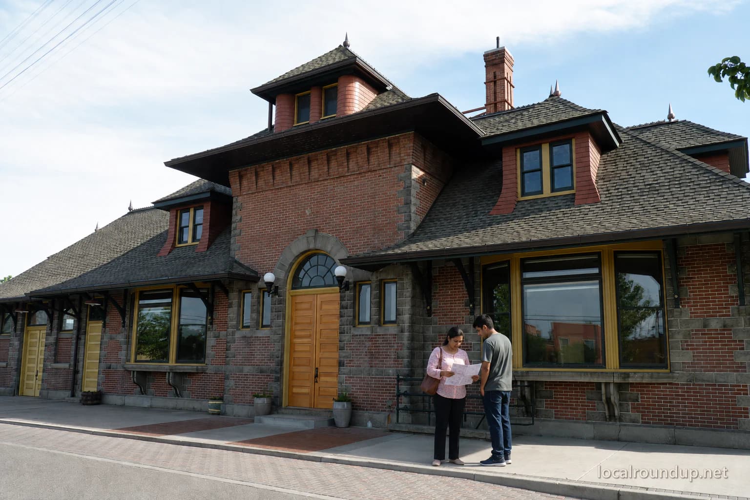
The National Register nomination describes the Weiser Oregon Short Line Railroad Depot as locally significant for both transportation history and architecture. The railroad reached the area in the 1880s; the substantial brick-and-stone depot opened in 1907. Its Richardsonian Romanesque details—including heavy masonry and arches—projected permanence at a time when Weiser expected continued growth as a railhead.
Walk around only from public areas and observe the material changes: brick walls, stone or cast-stone trim, arched openings, broad roof, and the building's position at the end of the street. Do not assume the platform, trackside space, or interior is publicly accessible. A historic listing documents significance; it is not an admission ticket.
Follow the development pattern north
The city's preservation plan explains that an earlier wooden depot stood near the west side of town and that an 1890 fire destroyed much of the early business district. Commercial and residential development then concentrated near State and Main streets. Mining activity in the Seven Devils and railroad connections helped Weiser grow from about 700 people in 1886 to roughly 3,500 by 1910.
That history gives the walk a question: how did the station pull activity toward it? Move from the depot toward State and Main, watching how the street axis connects the transportation landmark with the commercial center. Use the preservation plan's maps rather than wandering onto private residential property. Photograph facades from sidewalks, keep entrances clear, and treat active businesses as businesses rather than exhibits.
Add the Intermountain Institute as a separate stop
The preservation plan identifies the former Intermountain Institute as another major early-20th-century story. Reverend Edward A. Paddock founded it in 1899 for rural children who lived too far away to attend high school. Students combined academic work with manual training or domestic science and labor that helped cover their education. Campus buildings rose between 1907 and 1929.
Hooker Hall, built in 1924, now houses the Snake River Heritage Museum, according to the plan. That makes it the logical place to seek deeper local interpretation, but current hours must come from the museum operator on the day of planning. If no reliable current schedule is posted, keep the stop exterior-only or call ahead. Do not infer that every former campus building is museum space.
Keep the route modest and weather-aware
This is not a mileage challenge. The useful version spends time at three zones—the depot, State and Main, and the institute grounds—rather than collecting every listed building. Choose a cool part of the day, carry water, and use marked crossings. Visitors with limited mobility should preview curb ramps, surface conditions, and the distance between zones; driving between the depot and museum may be more sensible than presenting the whole route as one continuous walk.
Winter ice and summer heat can make exterior study unpleasant. A closed museum or bad weather does not erase the depot's significance, but it can shrink the plan to a short photography stop. Pair the route with a current event only after checking whether street closures change parking.
Avoid two interpretation mistakes
First, do not call every old brick building a railroad building. The preservation plan documents several forces—rail, mining, agriculture, education, and automobile travel—that overlapped. Second, do not turn the town's aspirations into a joke. The National Register record notes that boosters imagined dramatic growth; the surviving depot matters because it shows how seriously communities invested in rail connections.
Before departure, save the preservation plan, confirm any museum hours, and decide which stops will remain exterior-only. The result is a focused local-history outing grounded in documented buildings, not a loose list of photogenic addresses.
Keep a short observation list: building material, arch shape, roofline, and relationship to the street. Those four details make comparisons useful without requiring entry, trespass, or guesses about how a privately occupied building is used today.
Check the details
Dates and rules can change. These are the organizer and venue pages used for the practical details in this guide.
- Primary planning source 1
Supports the guide's operating, access, safety, or historical planning claims; retrieved 2026-09-05.
- Primary planning source 2
Supports the guide's operating, access, safety, or historical planning claims; retrieved 2026-09-05.
- Primary planning source 3
Supports the guide's operating, access, safety, or historical planning claims; retrieved 2026-09-05.
- Primary planning source 4
Supports the guide's operating, access, safety, or historical planning claims; retrieved 2026-09-05.
- Hero image source: Terrisr, CC BY-SA 3.0 (adapted)
The hero collage is adapted under CC BY-SA 3.0; edge objects were removed, people were added, and the image was cropped, retouched, and watermarked. The derivative image is offered under CC BY-SA 3.0: https://creativecommons.org/licenses/by-sa/3.0/.